Current Conditions
♦
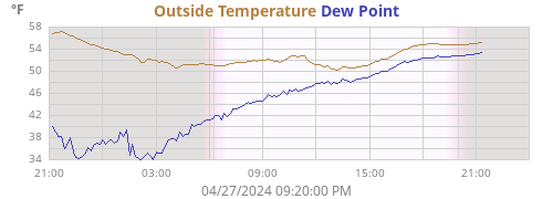
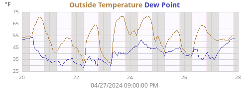
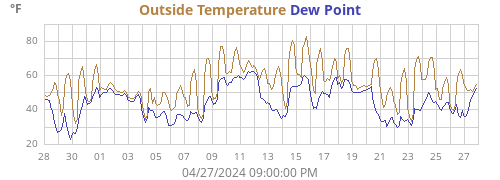
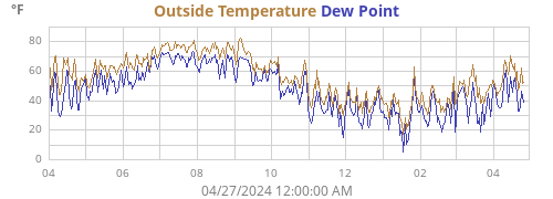
| Outside Temperature | 77.1°F |
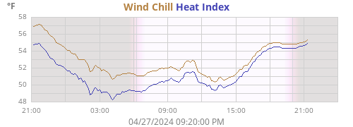
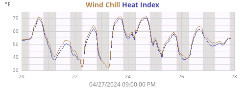
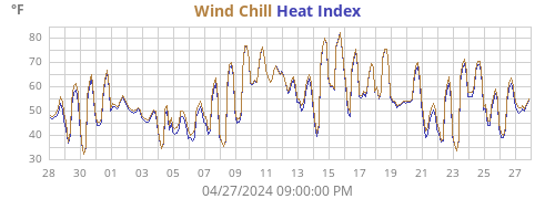
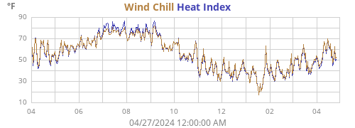
| Heat Index | 78.0°F |
| Wind Chill | 77.1°F |
| Dew Point | 68.2°F |
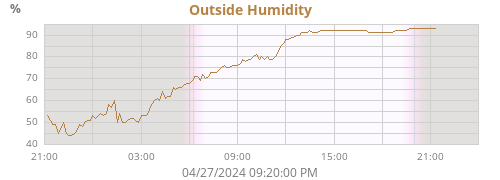
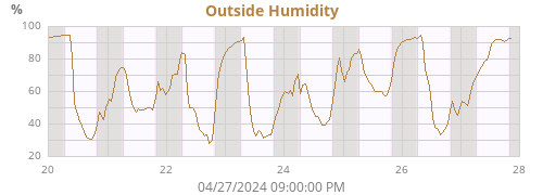
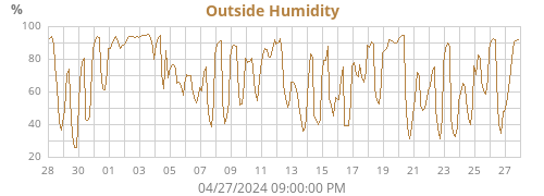
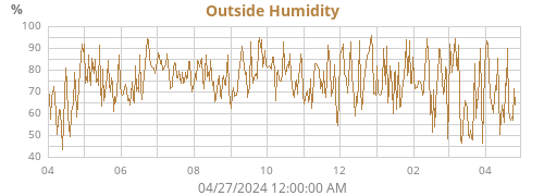
| Outside Humidity | 74% |
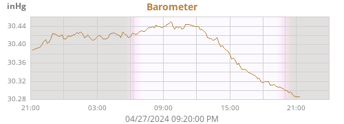
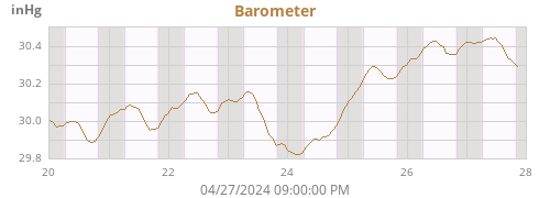
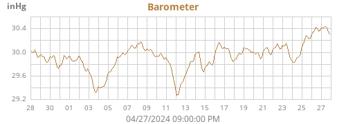
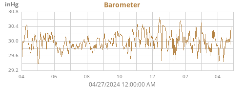
| Barometer | 30.150 inHg (0.023) |
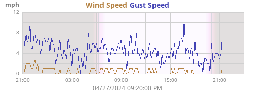
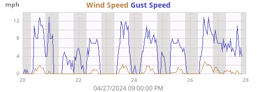
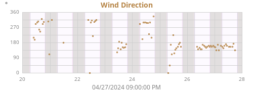
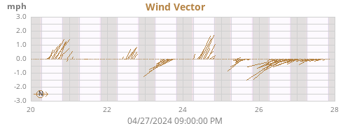
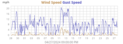
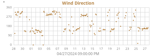
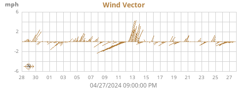
| Wind | 0 mph N/A ( N/A) |
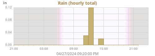
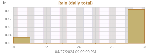
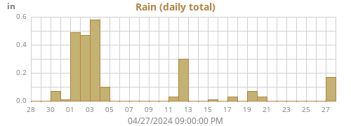
| Rain Today | 0.00 in |
| Rain Rate | 0.00 in/h |
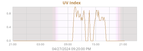
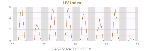
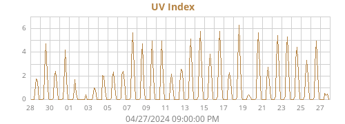
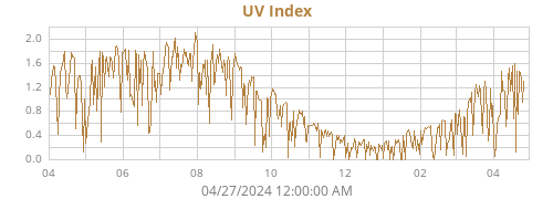
| UV Index | 0.0 |
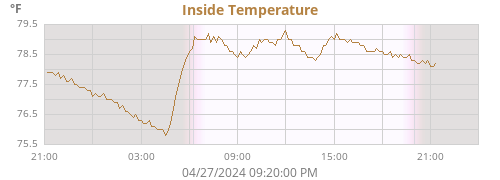
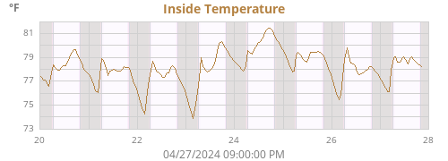
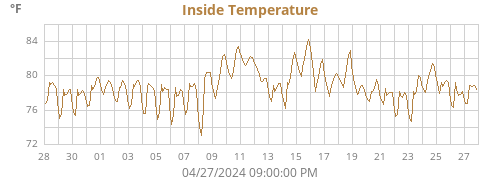
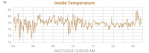
| Inside Temperature | 72.6°F |
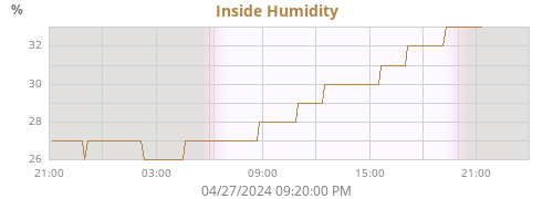
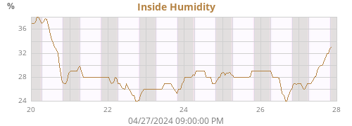
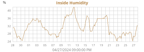
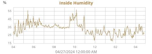
| Inside Humidity | 43% |
| Today |
Week |
Month |
Year |
Rain Year |
||
|---|---|---|---|---|---|---|
| Outside Temperature |
85.0 61.4 |
85.0 61.4 |
99.2 61.4 |
99.2 3.3 |
99.2 3.3 |
°F |
| Heat Index |
89.6 61.7 |
91.9 61.7 |
126.2 61.7 |
126.2 3.3 |
126.2 3.3 |
°F |
| Wind Chill |
85.0 61.4 |
85.0 61.4 |
99.2 61.4 |
99.2 -7.0 |
99.2 -7.0 |
°F |
| Dew Point |
72.8 60.0 |
75.9 60.0 |
84.0 60.0 |
84.0 -7.3 |
84.0 -7.3 |
°F |
| Outside Humidity |
97 54 |
97 54 |
97 49 |
97 23 |
97 23 |
% |
| Barometer |
30.224 30.125 |
30.224 29.998 |
30.224 29.808 |
30.742 29.216 |
30.742 29.216 |
inHg |
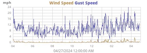
| Max Wind |
8 121 |
14 182 |
14 182 |
27 112 |
27 112 |
mph ° |
| Average Wind | 0 | 0 | 0 | 0 | 0 | mph |
| RMS Wind | 0 | 1 | 0 | 1 | 1 | mph |
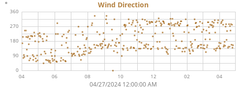
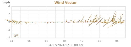
|
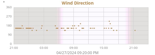
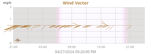
Vector Average Vector Direction |
0 146 |
0 147 |
0 145 |
0 207 |
0 207 |
mph ° |
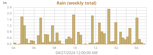
| Rain | 0.00 | 0.73 | 3.29 | 14.55 | 14.55 | in |
| Rain Rate | 0.00 | 6.70 | 6.70 | 6.70 | 6.70 | in/h |
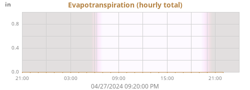
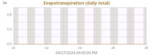
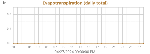
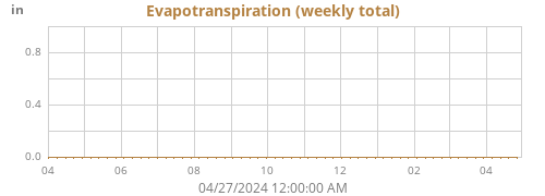
| Evapotranspiration | 0.00 | 0.00 | 0.00 | 0.00 | 0.00 | in |
| UV Index | 6.4 | 6.4 | 8.1 | 9.0 | 9.0 | |
| Inside Temperature |
76.2 72.6 |
76.2 71.4 |
78.0 68.5 |
89.7 66.5 |
89.7 66.5 |
°F |
| Inside Humidity |
47 43 |
47 41 |
49 39 |
59 14 |
59 14 |
% |
| Connectivity | ||
|---|---|---|
| Signal Quality | 100% | |
| Battery Status | ||
| Transmitter Battery | LOW | |
| Voltage | ||
| Console Battery | 4.7 V |
About this station
♦
| Hardware | Vantage Pro2 |
| Latitude | 39° 09.48' N |
| Longitude | 077° 41.94' W |
| Altitude | 484 feet |
| Server uptime | 0 days, 23 hours, 25 minutes |
| WeeWX uptime | 0 days, 23 hours, 25 minutes |
| WeeWX version | 5.1.0 |
| Skin | Seasons 5.1.0 |